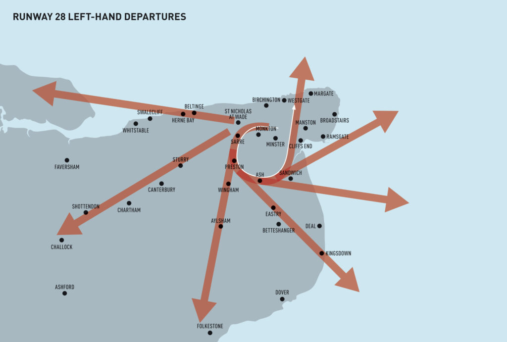
Manston airport in East Kent is to be developed into a major international cargo hub with all-new flight paths. These maps show some of the proposed flight paths developers are requesting which will affect many populated areas of East Kent
These proposals have been discussed and developed behind closed doors. CARMA (Campaign Against The Reopening of Manston Airport) is asking for transparency on consultations so that all those potentially affected can understand the environmental impact of the airport development.
Current proposals reveal over 30 East Kent locations which are at risk of being impacted by Manston’s proposed flightpaths. The routes shown here are taken from the most recent consultation documents.
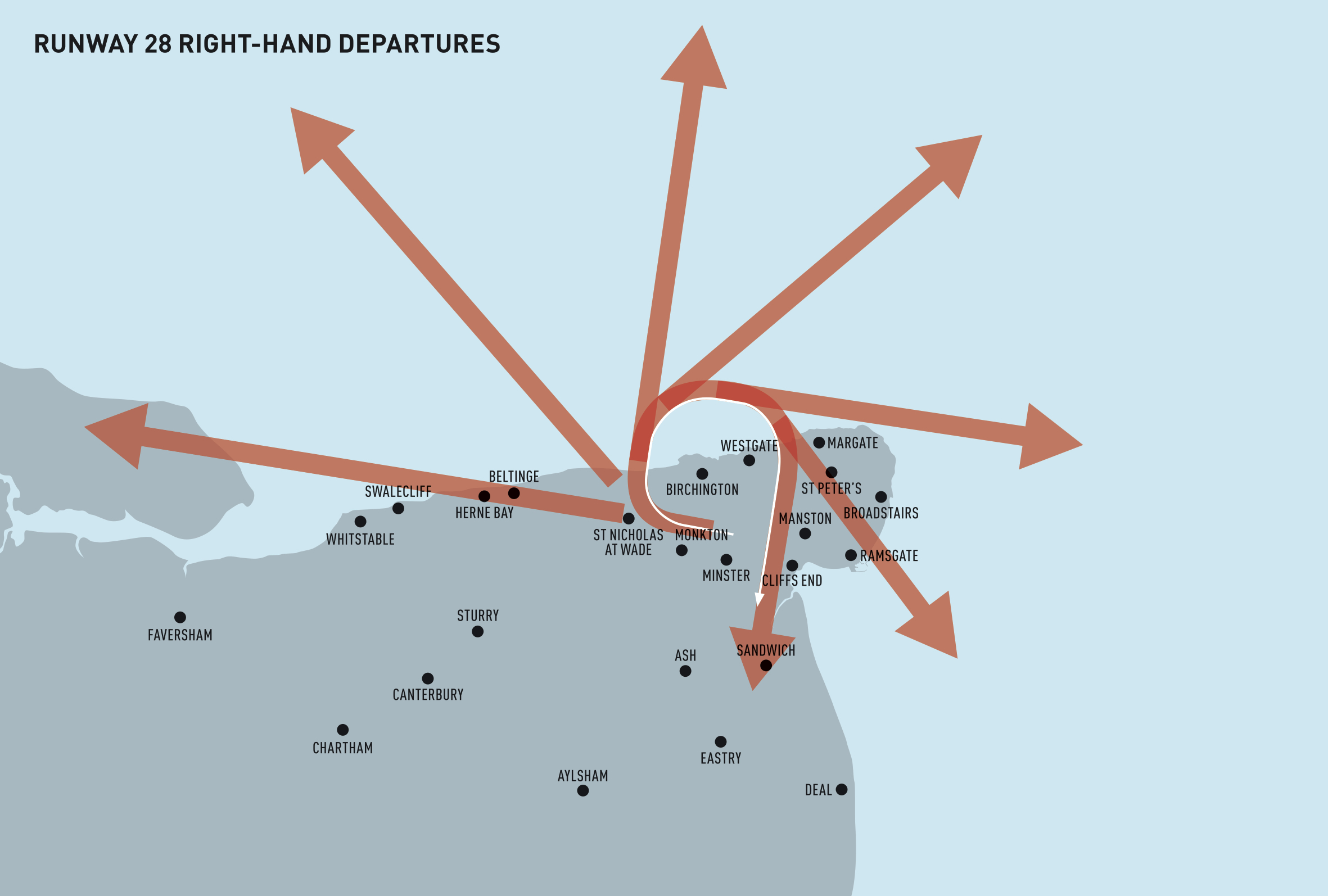
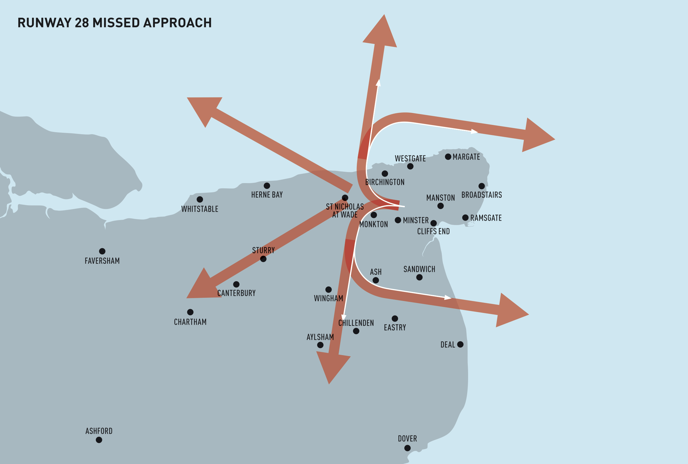
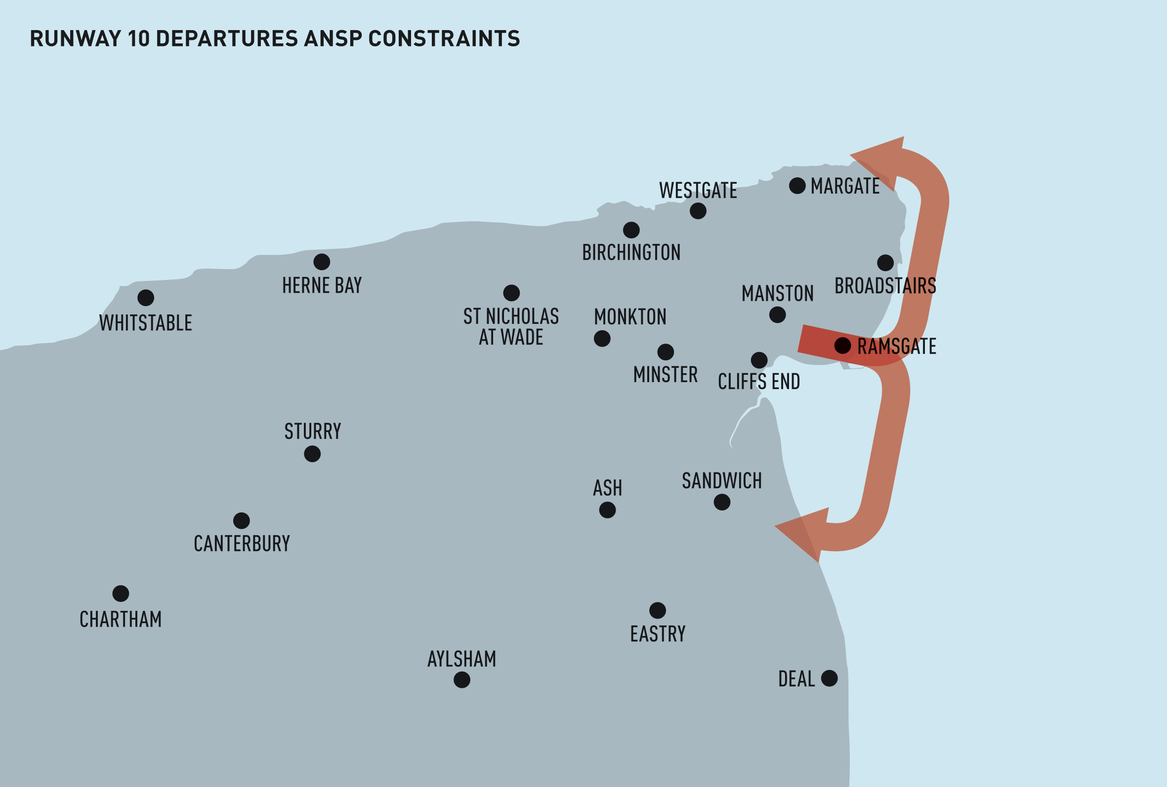
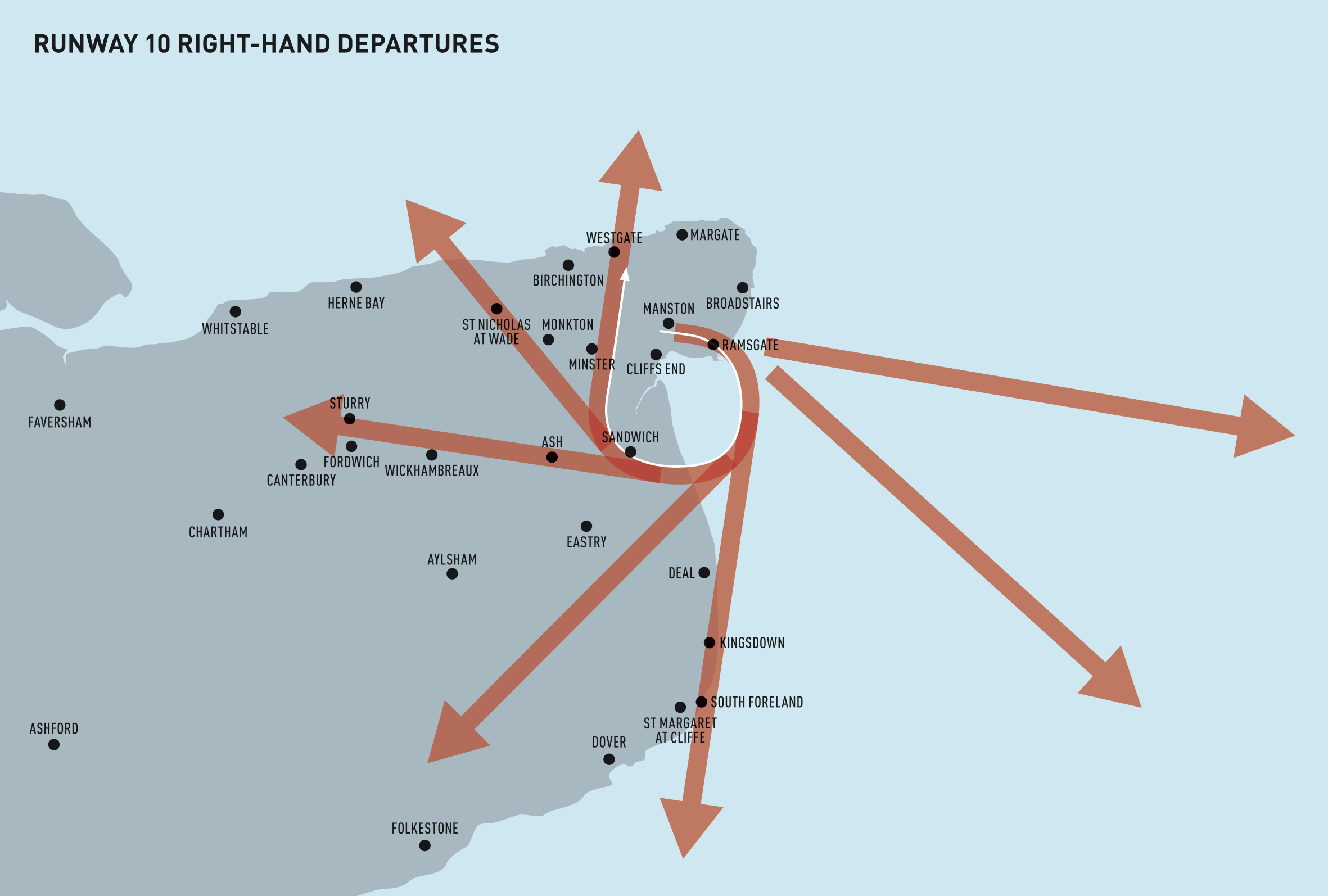
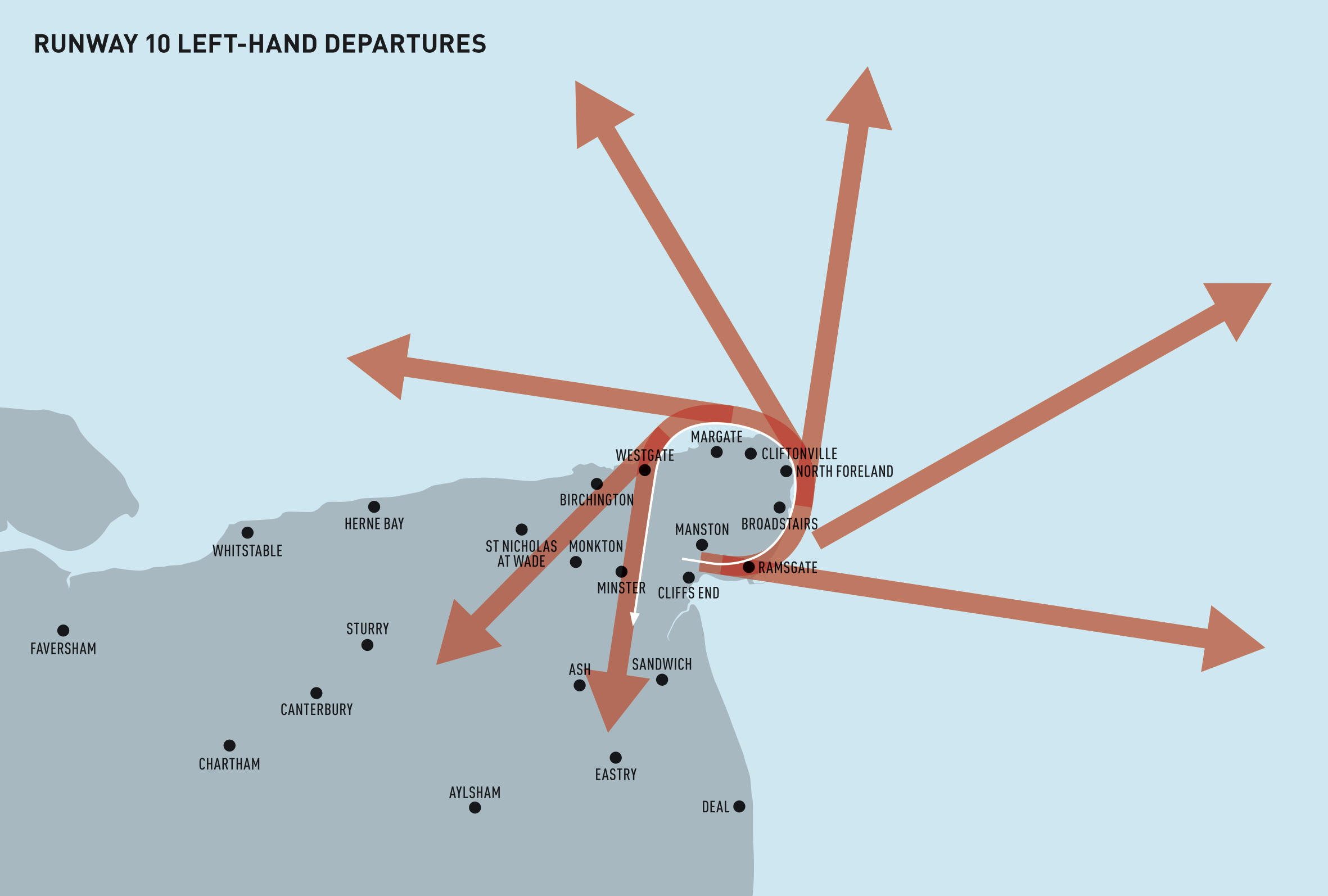
Areas at risk include: Ramsgate, Margate, Broadstairs, Sandwich, Deal, St Nicholas at Wade, Sturry, Ash, Wingham, Herne Bay, Beltinge, Swalecliff, Cliffsend, Eastry, Betteshanger, Sarre, Preston, Shottendon, Challock, Kingsdown, Folkestone, Birchington, St Peters, North Foreland, Cliftonville, Westgate, St Margaret At Cliffe, Fordwich, Wickhambreaux, South Foreland, Monkton, Chillenden and Canterbury.
The next stage of consultations will get under way in September.
If you, or your council representative, weren’t consulted and feel that you should be, please sign our petition – click here – to ask the Civil Aviation Authority for more transparency over the consultations for the development of the new Manston flight paths. Alternatively ask your local councillor to contact manstonairspace@communityrelations.co.uk with any concerns.
To download the latest flightpath proposal document from the airport developers click the red button below.
MANSTON AIRPORT: THE FACTS
Flight frequency
Manston has permission to develop 64,000 air traffic movements a year, which is 176 flights a day or around 10 flights an hour. There is currently no limit on the number late arrivals at night.
Flight paths
A normal flight path corridor can be up to 14km wide. The flight path corridors (red lines) on these maps demonstrate a width of approx 1km. Manston developers admit they have no control over the exact path each aircraft eventually chooses
Pollution
Cargo planes are the noisiest and most polluting types of aircraft. As a dedicated cargo hub Manston will primarily be flying planes converted to freight-only use from older passenger planes – such as the recently- retired 747s.
Climate Change
The Manston Airport would use up 1.9% of the UK’s target CO2 emissions for 2050. Planning experts say this will seriously affect the ability of the UK Govt to meet its carbon reduction targets, and Planning Inspectors have already concluded that there is no national need for an airport development at Manston.
Noise
Experts say that anything above 85 decibels can damage your hearing. Noise levels under previous flight Manston paths have been measured as loud as 100 db.
Please sign our online petition – click here – if you want more transparency on consultations about the new Manston flight paths so that those affected can understand the real environmental impact of the new airport proposals and development.